2015
ST4234 : Sutton Rhyne Bottom Pen
taken 9 years ago, near to Henley, Somerset, England
This is 1 of 2 images, with title Sutton Rhyne Bottom Pen in this square
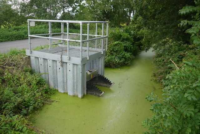
Sutton Rhyne Bottom Pen
This would appear to be some kind of sluice gate although why it is called a "bottom pen" I am not sure. It could be a shortened version of penstock. It is on the rhyne running alongside the Nythe Rd (visible on the left) and is part of the system draining Sutton Moor. See ST4234 : Information Notice Sutton Rhyne Bottom Pen
 Map © Crown Copyright")
TIP: Click the map for more Large scale mapping
- Grid Square
- ST4234, 19 images (more nearby 🔍)
- Photographer
- Nigel Mykura (more nearby)
- Date Taken
- Wednesday, 5 August, 2015 (more nearby)
- Submitted
- Wednesday, 28 December, 2016
- Subject Location
-
OSGB36:
 ST 4287 3405 [10m precision]
WGS84: 51:6.1734N 2:49.0402W - Camera Location
-
OSGB36: ST 4287 3403
- View Direction
- NORTH (about 0 degrees)