2016
TQ4889 : Billet Road
taken 7 years ago, near to Collier Row, Havering, England
Billet Road
Furze Hill Farm is the last remnant in Barking & Dagenham of the agricultural landscape which predominated until the 1920s. Although the fields here serve as a reminder of how most of Barking & Dagenham once looked, this particular farmland is of relatively recent origin. In the early 19th century this land lay within Hainault Forest. The name 'Furze House' refers to the heathy nature of the Forest, furze being an old name for gorse. It was only after the removal of the Forest's legal protection in 1851 that this area was turned over to agricultural use. The area of open countryside here in the north of Barking & Dagenham was reduced to the current extent around 1960 when the Marks Gate housing estate to the south was completed.
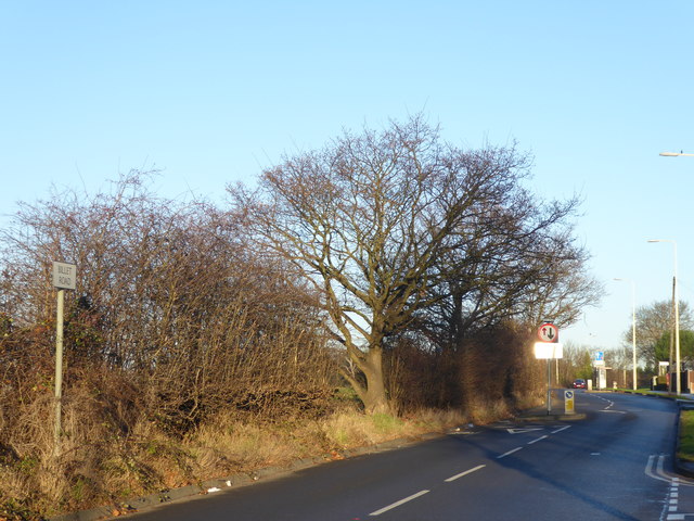
Billet Road is a classic example of how the Green Belt works. To the south (on the right) is the estate of Marks Gate while across the road (to the left) is open countryside. The land just across the road here belongs to Furze House Farm. This is at the junction with Hazel Grove.
Billet Road is a classic example of how the Green Belt works. To the south (on the right) is the estate of Marks Gate while across the road (to the left) is open countryside. The land just across the road here belongs to Furze House Farm. This is at the junction with Hazel Grove.
 Map © Crown Copyright")
TIP: Click the map for more Large scale mapping
- Grid Square
- TQ4889, 15 images (more nearby 🔍)
- Photographer
- Marathon (more nearby)
- Date Taken
- Thursday, 29 December, 2016 (more nearby)
- Submitted
- Thursday, 29 December, 2016
- Subject Location
-
OSGB36:
 TQ 4803 8992 [10m precision]
WGS84: 51:35.3216N 0:8.1246E - Camera Location
-
OSGB36: TQ 4802 8991
- View Direction
- North-northeast (about 22 degrees)