2007
SE0209 : Standedge Cutting
taken 17 years ago, near to Bleak Hey Nook, Oldham, England
This is 1 of 5 images, with title Standedge Cutting in this square
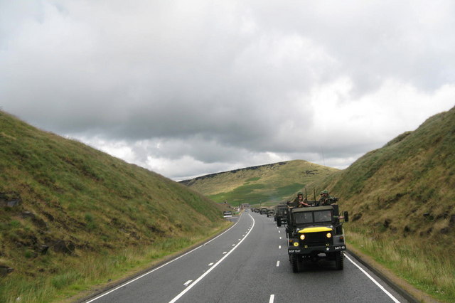
Standedge Cutting
Taken during the Yanks Event Link (Archive Link ) the convoy passes through Stanedge Cutting.
SE0210 : Yanks Event
SD9906 : Yanks are back in Saddleworth
SD9806 : The Woolpack Inn Dobcross
SD9905 : Yanks in the High Street Uppermill
Built in 1839 Standedge Cutting carries the A62 trunk road that used to be the main route between Lancashire and Yorkshire over the pennines before the opening in 1970 of the M62 motorway further north.
 Map © Crown Copyright")
TIP: Click the map for more Large scale mapping
- Grid Square
- SE0209, 62 images (more nearby 🔍)
- Photographer
- Paul Anderson (more nearby)
- Date Taken
- Sunday, 12 August, 2007 (more nearby)
- Submitted
- Monday, 13 August, 2007
- Subject Location
-
OSGB36:
 SE 024 098 [100m precision]
WGS84: 53:35.1139N 1:57.9132W - Camera Location
-
OSGB36: SE 023 097
- View Direction
- Northeast (about 45 degrees)