2016
SE1563 : Hollin House Mill Leat
taken 7 years ago, near to Bewerley, North Yorkshire, England
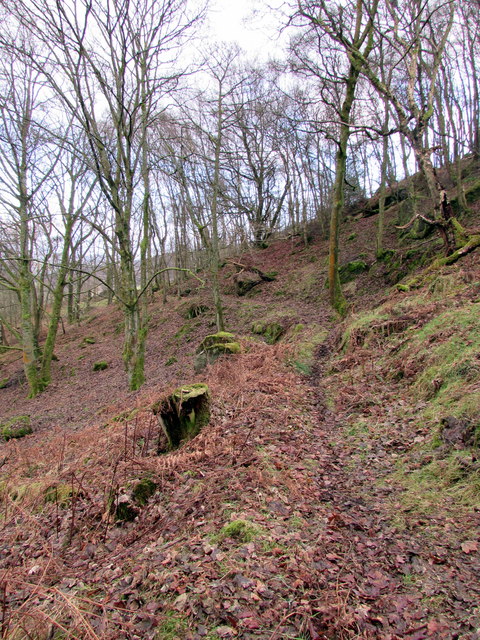
Hollin House Mill Leat
Remains of the mile and half long watercourse that supplied power to Hollin House Mill near Glasshouses from Ravensgill (also known as Fosse Gill).
 Map © Crown Copyright")
TIP: Click the map for more Large scale mapping
- Grid Square
- SE1563, 65 images (more nearby 🔍)
- Photographer
- Matthew Hatton (more nearby)
- Date Taken
- Friday, 30 December, 2016 (more nearby)
- Submitted
- Saturday, 31 December, 2016
- Subject Location
-
OSGB36:
 SE 1588 6386 [10m precision]
WGS84: 54:4.2260N 1:45.5298W - Camera Location
-
OSGB36: SE 1583 6388
- View Direction
- East-southeast (about 112 degrees)