2017
NH6856 : Footpath at the edge of Arkendeith Wood
taken 7 years ago, near to Avoch, Highland, Scotland
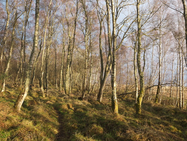
Footpath at the edge of Arkendeith Wood
A clear path (not visible on OS mapping) runs along the southern flank of Arkendeith Wood forming part of a circular walk that can be enjoyed from the parking area beside the Rosehaugh Estate at the junction of the roads from Fortrose and Avoch towards Killen.
 Map © Crown Copyright")
TIP: Click the map for more Large scale mapping
- Grid Square
- NH6856, 39 images (more nearby 🔍)
- Photographer
- Julian Paren (more nearby)
- Date Taken
- Monday, 2 January, 2017 (more nearby)
- Submitted
- Monday, 2 January, 2017
- Subject Location
-
OSGB36:
 NH 6887 5630 [10m precision]
WGS84: 57:34.6594N 4:11.6700W - Camera Location
-
OSGB36: NH 68858 56301
- View Direction
- East-northeast (about 67 degrees)