2016
SO9234 : The Northway
taken 7 years ago, near to Northway, Gloucestershire, England
This is 1 of 3 images, with title The Northway in this square
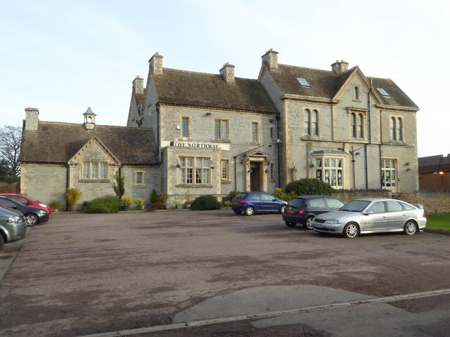
The Northway
The Northway is a large pub serving the Northway housing estate which now surrounds the much older house. Formerly it was Northway House which was built in 1851 for William Woodward. The building is Grade II listed.
Historic England description
Former private house now public house. Dated and initialled. 'W.W. 1851' (William Woodward) on limestone shield on right gable end. Blue lias with ashlar quoins. Fishscale ceramic tile roof. Blue lias stacks with ashlar quoins. Wall blue lias with brick piers. Rectangular plan to house with extensions to right of entrance front. 2½ storeys. Symmetrical, 3-windowed facade to main body with gabled projecting central bay with central round- headed entrance with keystone. Part-glazed double door within porch. Canted oriel window above. Two-light round-headed sash windows to flanking bays within limestone surrounds. Hoodmoulded with console supports over ground floor Windows. Return, left, two bay windows to ground floor with pierced parapet. Two-bay extension to right of entrance front lit by 3-light stone-mullioned casements with glazing bars. Axial and gable end stacks. Wall adjoining right gable end of extension falls away gradually from c4.5m to c2m in height to right in a series of concave sweeps. Moulded cappings and ball finials to wall piers. Interior not inspected.
Source: Link
 Map © Crown Copyright")
TIP: Click the map for more Large scale mapping
- Grid Square
- SO9234, 29 images (more nearby 🔍)
- Photographer
- Philip Halling (more nearby)
- Date Taken
- Tuesday, 27 December, 2016 (more nearby)
- Submitted
- Saturday, 7 January, 2017
- Subject Location
-
OSGB36:
 SO 9241 3407 [10m precision]
WGS84: 52:0.3008N 2:6.7188W - Camera Location
-
OSGB36: SO 92391 34086
- View Direction
- East-southeast (about 112 degrees)