1998
SJ4826 : Sleap Airfield from the north
taken 26 years ago, near to Sleap, Shropshire, England
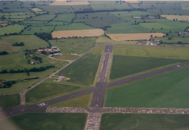
Sleap Airfield from the north
 Map © Crown Copyright")
TIP: Click the map for more Large scale mapping
- Grid Square
- SJ4826, 25 images (more nearby 🔍)
- Photographer
- Donald Farnworth (more nearby)
- Date Taken
- Wednesday, 22 July, 1998 (more nearby)
- Submitted
- Monday, 13 August, 2007
- Subject Location
-
OSGB36:
 SJ 482 267 [100m precision]
WGS84: 52:50.1350N 2:46.2223W - Camera Location
-
OSGB36: SJ 481 273
- View Direction
- SOUTH (about 180 degrees)