2017
SZ1392 : West Southbourne: makeshift surface repair on footpath H09
taken 7 years ago, near to Pokesdown, Bournemouth, Christchurch & Poole, England
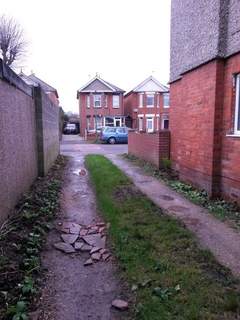
West Southbourne: makeshift surface repair on footpath H09
This is one of seven public footpaths running parallel with and either side of Kimberley Road, serving as rear driveway access to the properties on that road. Complementing the criss-cross arrangements of roads in West Southbourne, they are arranged in the following order:
(northeast side of Kimberley Road)
Castlemain Avenue - footpath H09 - Beaufort Road - footpath H10 - Stamford Road - footpath H13 - Arnewood Road - footpath H14 - Irving Road
(southwest side of Kimberley Road)
Beaufort Road - footpath H11 - Stamford Road - footpath H12 - Arnewood Road - footpath H15 [called Irving Lane] - Irving Road
Here, we look towards Castlemain Avenue on footpath H09, across a part of the surface where a pothole has been levelled with some broken-up slates or chimneypots.
See SZ1392 : West Southbourne: across Slow markings and along footpath H09 for the view towards us from across the road, and SZ1392 : West Southbourne: offset garages on footpath H09 for the next view on the path ahead, with links to further photos along the route.
Public rights of way in Bournemouth
A series of pictures documenting the public rights of way in the borough of Bournemouth. The pictures of the rights of way all have links to the next picture on the same route, in each direction.
The rights of way are all documented, in numerical order, in this article:
Link
 Map © Crown Copyright")
TIP: Click the map for more Large scale mapping
- Grid Square
- SZ1392, 150 images (more nearby 🔍)
- Photographer
- Chris Downer (more nearby)
- Date Taken
- Sunday, 8 January, 2017 (more nearby)
- Submitted
- Sunday, 8 January, 2017
- Subject Location
-
OSGB36:
 SZ 1336 9247 [10m precision]
WGS84: 50:43.9017N 1:48.7238W - Camera Location
-
OSGB36: SZ 1337 9247
- View Direction
- Northwest (about 315 degrees)