2016
NZ2362 : Ship loading machinery on Dunston Staiths
taken 8 years ago, near to Dunston, Gateshead, England
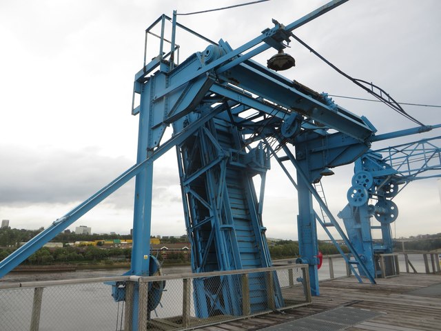
Ship loading machinery on Dunston Staiths
Preserved infrastructure used for loading coal into ships on Dunston Staiths.
 Map © Crown Copyright")
TIP: Click the map for more Large scale mapping
- Grid Square
- NZ2362, 219 images (more nearby 🔍)
- Photographer
- Graham Robson (more nearby)
- Date Taken
- Saturday, 24 September, 2016 (more nearby)
- Submitted
- Sunday, 15 January, 2017
- Subject Location
-
OSGB36:
 NZ 2346 6265 [10m precision]
WGS84: 54:57.4765N 1:38.1109W - Camera Location
-
OSGB36: NZ 2345 6265
- View Direction
- EAST (about 90 degrees)