2016
SE1199 : Benchmark on Downholme Bridge
taken 8 years ago, near to Downholme, North Yorkshire, England
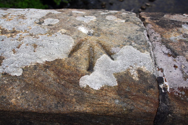
Benchmark on Downholme Bridge
Ordnance Survey pivot benchmark described on the Bench Mark Database at Link
 Map © Crown Copyright")
TIP: Click the map for more Large scale mapping
- Grid Square
- SE1199, 51 images (more nearby 🔍)
- Photographer
- Roger Templeman (more nearby)
- Date Taken
- Friday, 27 May, 2016 (more nearby)
- Submitted
- Monday, 16 January, 2017
- Subject Location
-
OSGB36:
 SE 1135 9916 [10m precision]
WGS84: 54:23.2681N 1:49.6039W - Camera Location
-
OSGB36: SE 1135 9916
- View Direction
- SOUTH (about 180 degrees)