2017
HU2678 : View over Sand Wick from the B9078
taken 7 years ago, near to Burnside, Mainland, Shetland Islands, Scotland
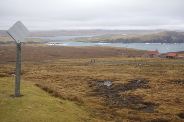
View over Sand Wick from the B9078
The lozenge shaped sign denotes a passing place on the single track B9078. Beyond that is the track to Zoar, with the red roof on the extreme right, and in the distance is Sand Wick and Ura Firth divided by the isthmus at Hillswick.
 Map © Crown Copyright")
TIP: Click the map for more Large scale mapping
- Grid Square
- HU2678, 10 images (more nearby 🔍)
- Photographer
- Stephen McKay (more nearby)
- Date Taken
- Wednesday, 1 February, 2017 (more nearby)
- Submitted
- Tuesday, 7 February, 2017
- Subject Location
-
OSGB36:
 HU 2650 7800 [10m precision]
WGS84: 60:29.0898N 1:31.1799W - Camera Location
-
OSGB36: HU 2642 7804
- View Direction
- East-southeast (about 112 degrees)