2017
SX3657 : St Germans Quay
taken 7 years ago, near to St Germans, Cornwall, England
This is 1 of 14 images, with title St Germans Quay in this square
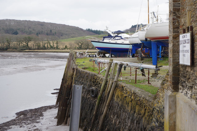
St Germans Quay
Originally used for the loading of quarried stone, the quay has been used by the Quay Sailing Club since the early 1970s.
River Tiddy
River Tiddy
River Tiddy
The River Tiddy (Cornish: Teudhi) is a small river in south-east Cornwall, the main tributary of the River Lynher. The Tiddy rises near Pensilva and flows south east past the village of Tideford until it joins the Lynher just after passing St Germans.
 Map © Crown Copyright")
TIP: Click the map for more Large scale mapping
- Grid Square
- SX3657, 127 images (more nearby 🔍)
- Photographer
- Stephen McKay (more nearby)
- Date Taken
- Saturday, 11 February, 2017 (more nearby)
- Submitted
- Tuesday, 14 February, 2017
- Subject Location
-
OSGB36:
 SX 3642 5708 [10m precision]
WGS84: 50:23.4474N 4:18.1564W - Camera Location
-
OSGB36: SX 3641 5709
- View Direction
- Southeast (about 135 degrees)