2017
NT2245 : Drove Road from West Linton
taken 7 years ago, 3 km from Eddleston, Scottish Borders, Scotland
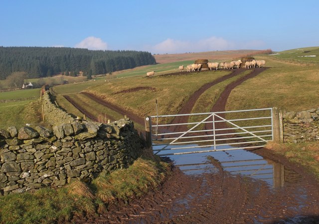
Drove Road from West Linton
The junction of the Drove Road with the Old Post Road to Shiplaw. Cattle were brought south via West Linton, through the Cloich Hills and on to Peebles to cross the Tweed en route to Traquair. Now the route is used by walkers and cyclists. In the background is the house at Upper Stewarton below Cloich Forest.
 Map © Crown Copyright")
TIP: Click the map for more Large scale mapping
- Grid Square
- NT2245, 45 images (more nearby 🔍)
- Photographer
- Jim Barton (more nearby)
- Date Taken
- Tuesday, 14 February, 2017 (more nearby)
- Submitted
- Wednesday, 15 February, 2017
- Subject Location
-
OSGB36:
 NT 2207 4589 [10m precision]
WGS84: 55:42.0106N 3:14.4902W - Camera Location
-
OSGB36: NT 2211 4586
- View Direction
- Northwest (about 315 degrees)