2017
NZ5910 : The path down Cockshaw Hill
taken 7 years ago, near to Kildale, North Yorkshire, England
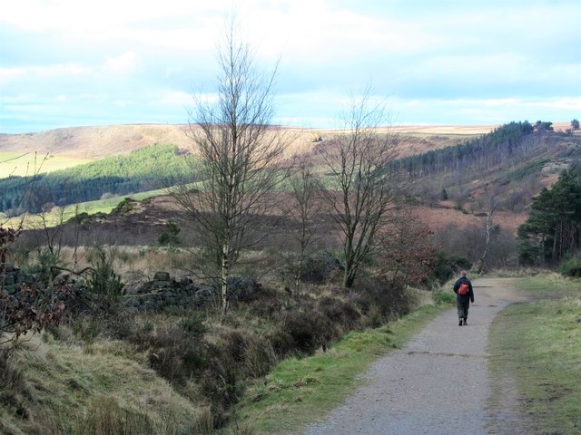
The path down Cockshaw Hill
A popular path that takes visitors uphill from a Forestry Commission car park to Captain Cook's Monument. A pleasant path spoiled by the numerous 'doggy poo' bags scattered everywhere and left in a pile by the car park.
 Map © Crown Copyright")
TIP: Click the map for more Large scale mapping
- Grid Square
- NZ5910, 84 images (more nearby 🔍)
- Photographer
- Gordon Hatton (more nearby)
- Date Taken
- Sunday, 19 February, 2017 (more nearby)
- Submitted
- Monday, 20 February, 2017
- Subject Location
-
OSGB36:
 NZ 5911 1070 [10m precision]
WGS84: 54:29.2924N 1:5.3433W - Camera Location
-
OSGB36: NZ 5907 1065
- View Direction
- North-northeast (about 22 degrees)