2017
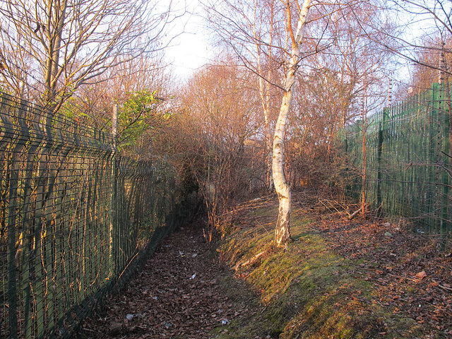
SE3230 : Public footpath from Pontefract Road to Queen Street (1)
taken 7 years ago, 3 km from Robin Hood, Leeds, England
This is 1 of 2 images, with title starting with Public footpath from Pontefract Road to Queen Street in this square
Public footpath from Pontefract Road to Queen Street (1)
The footpath is marked on the Explorer map; it looked to have had vegetation cleared quite recently and would probably have been impassable before that. As it only links Queen Street and Pontefract Road by a longer route than following the road, it probably gets little use other than by trainspotters (since it runs alongside the railway for part of its route).
 Map © Crown Copyright")
TIP: Click the map for more Large scale mapping
- Grid Square
- SE3230, 62 images (more nearby 🔍)
- Photographer
- Stephen Craven (more nearby)
- Date Taken
- Saturday, 18 February, 2017 (more nearby)
- Submitted
- Wednesday, 22 February, 2017
- Subject Location
-
OSGB36:
 SE 3241 3051 [10m precision]
WGS84: 53:46.1958N 1:30.5859W - Camera Location
-
OSGB36: SE 3241 3051
- View Direction
- North-northeast (about 22 degrees)