2016
SX0960 : Junction, Hillhead
taken 8 years ago, near to Lostwithiel, Cornwall, England
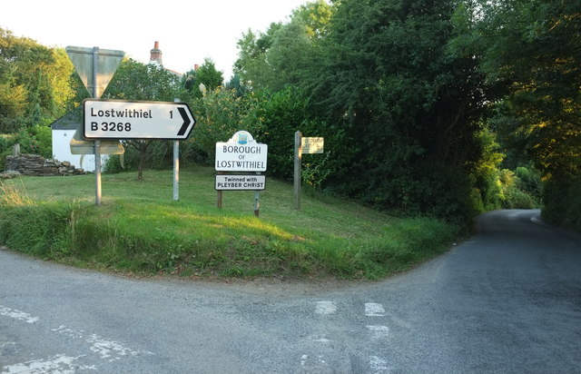
Junction, Hillhead
A side road, Bodmin Hill, leaves the B3268 on the left. Both roads drop down to Lostwithiel.
 Map © Crown Copyright")
TIP: Click the map for more Large scale mapping
- Grid Square
- SX0960, 15 images (more nearby 🔍)
- Photographer
- Derek Harper (more nearby)
- Date Taken
- Tuesday, 16 August, 2016 (more nearby)
- Submitted
- Saturday, 25 February, 2017
- Subject Location
-
OSGB36:
 SX 0985 6079 [10m precision]
WGS84: 50:24.9673N 4:40.6723W - Camera Location
-
OSGB36: SX 0985 6080
- View Direction
- SOUTH (about 180 degrees)