2016
NH0317 : Allt Grannda
taken 8 years ago, near to Sgùrr a' Dubh Doire [hill or Mountain], Highland, Great Britain
This is 1 of 2 images, with title Allt Grannda in this square
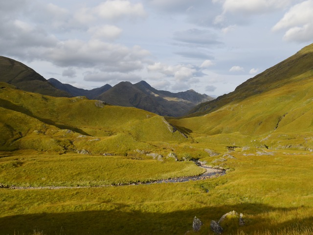
Allt Grannda
Looking west along the upper reaches of the Allt Grannda from the Affric-Kintail footpath.
 Map © Crown Copyright")
TIP: Click the map for more Large scale mapping
- Grid Square
- NH0317, 11 images (more nearby 🔍)
- Photographer
- Patrick Mackie (more nearby)
- Date Taken
- Monday, 3 October, 2016 (more nearby)
- Submitted
- Sunday, 26 February, 2017
- Subject Location
-
OSGB36:
 NH 035 172 [100m precision]
WGS84: 57:12.1987N 5:15.2822W - Camera Location
-
OSGB36: NH 0376 1715
- View Direction
- West-northwest (about 292 degrees)