2017
SZ1292 : Pokesdown: footpath J09 from Kings Park
taken 7 years ago, near to Pokesdown, Bournemouth, Christchurch & Poole, England
Pokesdown: footpath J09 from Kings Park
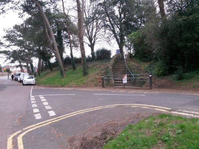
The driveway and churchyard path of the parish church of St. James the Greater form public footpath J09, cutting off the corner from King's Park to the main Christchurch Road.
Here, we view the start of the path from the King's Park end, with the steps leading up to the churchyard gate. Spurgeon Road is the sharp turn to our right.
(The zig-zag 'School Keep Clear' markings are there because the school is situated in the same grounds as the church, and this is a route used by pupils.)
See SZ1292 : Pokesdown: down the steps on footpath J09 for the view towards us from the top of the steps, with links to further photos along the route.
Public rights of way in Bournemouth
A series of pictures documenting the public rights of way in the borough of Bournemouth. The pictures of the rights of way all have links to the next picture on the same route, in each direction.
The rights of way are all documented, in numerical order, in this article:
Link
 Map © Crown Copyright")
TIP: Click the map for more Large scale mapping
- Grid Square
- SZ1292, 232 images (more nearby 🔍)
- Photographer
- Chris Downer (more nearby)
- Date Taken
- Saturday, 25 February, 2017 (more nearby)
- Submitted
- Sunday, 26 February, 2017
- Subject Location
-
OSGB36:
 SZ 1269 9261 [10m precision]
WGS84: 50:43.9782N 1:49.2932W - Camera Location
-
OSGB36: SZ 1269 9263
- View Direction
- SOUTH (about 180 degrees)