TR2555 : Claypits
taken 7 years ago, near to Goodnestone, Kent, England
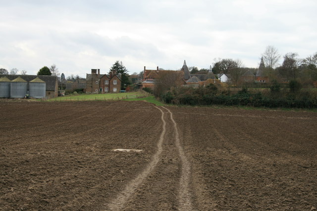
A path from opposite the church of St James the Great on The Street, Staple. It passes south-southwest along a track, initially metalled and known as Church Lane, to the junction with footpath EE191 to Buckland Lane and Summerfield, then continues southwest across two arable fields towards Twitham Hill to a junction with public bridleway EE28. It then continues in the same southwesterly direction over further arable fields to Claypits Farm, then following an enclosed path between hedges to emerge on Cave Lane at Claypits opposite the junction with Boyes Lane, Goodnestone. Beyond Church Lane, the path follows an almost direct bearing across arable fields all the way to Claypits. Recorded on the definitive map and statement for Kent as footpath EE190.
The path is well used today, but when surveyed by Goodnestone parish council in 1950 (to inform the first draft definitive map), it was recorded as 'no trace, not used'.
 Map © Crown Copyright")
- Grid Square
- TR2555, 34 images (more nearby 🔍)
- Photographer
- Hugh Craddock (more nearby)
- Date Taken
- Tuesday, 21 February, 2017 (more nearby)
- Submitted
- Tuesday, 28 February, 2017
- Subject Location
-
OSGB36:
 TR 2594 5522 [10m precision]
WGS84: 51:15.0819N 1:14.1798E - Camera Location
-
OSGB36: TR 2606 5538
- View Direction
- Southwest (about 225 degrees)