2017
TQ1850 : Boxhill Road
taken 7 years ago, near to Dorking, Surrey, England
This is 1 of 4 images, with title Boxhill Road in this square
Boxhill Road
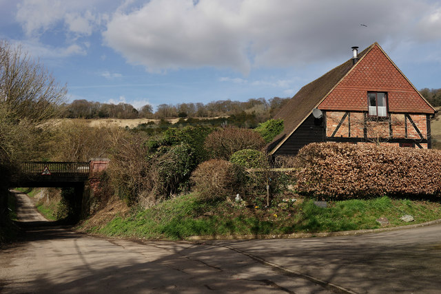
Looking towards the railway bridge, which carries the line from Redhill to Guildford. Beyond, lies the southern face of Box Hill.
 Map © Crown Copyright")
TIP: Click the map for more Large scale mapping
- Grid Square
- TQ1850, 128 images (more nearby 🔍)
- Photographer
- Peter Trimming (more nearby)
- Date Taken
- Thursday, 9 March, 2017 (more nearby)
- Submitted
- Sunday, 12 March, 2017
- Subject Location
-
OSGB36:
 TQ 1828 5054 [10m precision]
WGS84: 51:14.5071N 0:18.4156W - Camera Location
-
OSGB36: TQ 1830 5049
- View Direction
- North-northwest (about 337 degrees)