2017
SK6108 : St Theodore's Church, Rushey Mead
taken 7 years ago, near to Thurmaston, Leicestershire, England
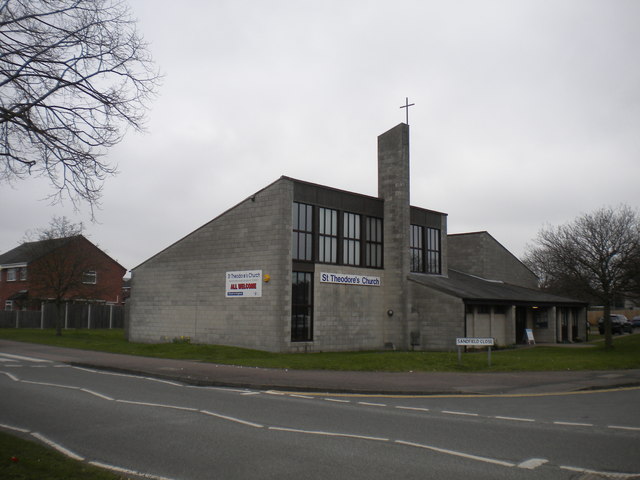
St Theodore's Church, Rushey Mead
Just off Nicklaus Road.
 Map © Crown Copyright")
TIP: Click the map for more Large scale mapping
- Grid Square
- SK6108, 23 images (more nearby 🔍)
- Photographer
- Richard Vince (more nearby)
- Date Taken
- Saturday, 11 March, 2017 (more nearby)
- Submitted
- Monday, 13 March, 2017
- Subject Location
-
OSGB36:
 SK 6105 0825 [10m precision]
WGS84: 52:40.1120N 1:5.9194W - Camera Location
-
OSGB36: SK 6102 0825
- View Direction
- East-northeast (about 67 degrees)