2017
NZ3143 : Location of old coal mine
taken 7 years ago, near to Carrville, County Durham, England
Location of old coal mine
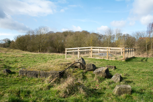
The location, close to the flow of Pittington Beck lies to the east of the Belmont district of Durham city.
There's the remains of masonry in the foreground and out of view to the left is an amount of grassed-over mine spoil. The wooden-fenced enclosure is surely the site of a mineshaft, now capped of course.
There's the remains of masonry in the foreground and out of view to the left is an amount of grassed-over mine spoil. The wooden-fenced enclosure is surely the site of a mineshaft, now capped of course.
 Map © Crown Copyright")
TIP: Click the map for more Large scale mapping
- Grid Square
- NZ3143, 13 images (more nearby 🔍)
- Photographer
- Trevor Littlewood (more nearby)
- Date Taken
- Thursday, 2 March, 2017 (more nearby)
- Submitted
- Tuesday, 14 March, 2017
- Subject Location
-
OSGB36:
 NZ 3167 4374 [10m precision]
WGS84: 54:47.2538N 1:30.5429W - Camera Location
-
OSGB36: NZ 3170 4374
- View Direction
- WEST (about 270 degrees)