2017
SP3166 : Clarendon Crescent frontages, Leamington
taken 7 years ago, near to Royal Leamington Spa, Warwickshire, England
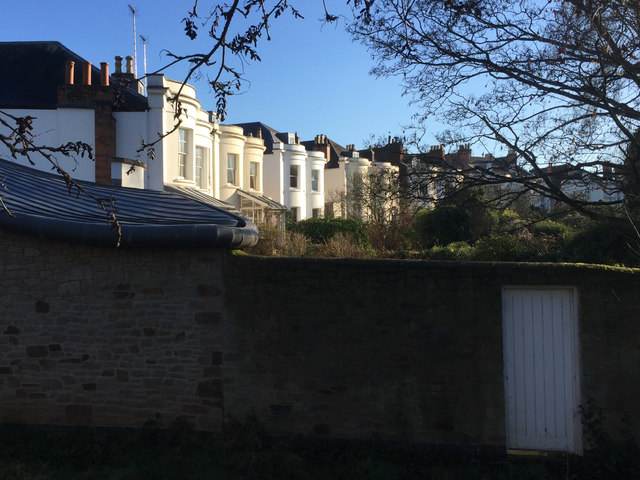
Clarendon Crescent frontages, Leamington
The bow-fronted houses face in across their own private gardens to communal ground beyond, once known as the Dingle, through which may still flow the Binsbrook. The Crescent was laid out c1825; all nine houses are listed Grade II. The assertion in the listing details that the Crescent was planned as Bertie Circus is almost certainly a misunderstanding: a complete circle would have crossed an ownership boundary and a steep-sided brook valley. The view is from the Strathearn Gardens open space.
 Map © Crown Copyright")
TIP: Click the map for more Large scale mapping
- Grid Square
- SP3166, 570 images (more nearby 🔍)
- Photographer
- Robin Stott (more nearby)
- Date Taken
- Friday, 20 January, 2017 (more nearby)
- Submitted
- Saturday, 18 March, 2017
- Subject Location
-
OSGB36:
 SP 3136 6629 [10m precision]
WGS84: 52:17.6310N 1:32.4966W - Camera Location
-
OSGB36: SP 3132 6633
- View Direction
- Southeast (about 135 degrees)