2017
ST6184 : Old Milestone by the A38, Gloucester Road, Almondsbury
taken 7 years ago, near to Almondsbury, South Gloucestershire, England
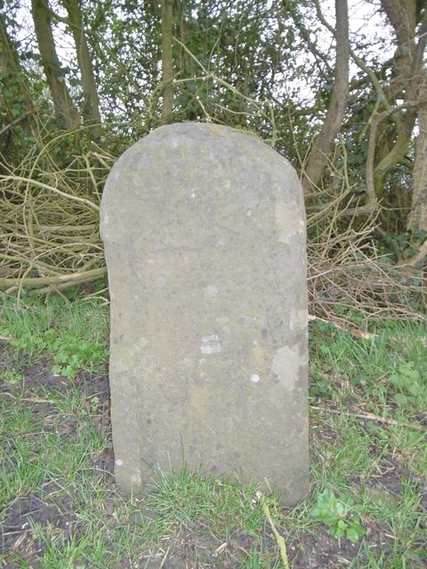
Old Milestone by the A38, Gloucester Road, Almondsbury
Stone post (plate lost) by the A38, in parish of ALMONDSBURY (SOUTH GLOUCESTERSHIRE District), Gloucester Road, next to M5, 10m South of road bridge on grass verge, on South-East side of road. Bristol incised iron plate, erected by the Bristol Turnpike Trust in the 19th century.
Inscription once read:-
(To)
(Bristol)
(7)
Like many others in the Bristol area, the plate was probably removed as a security measure in WWII.
Milestone Society National ID: GL_BRGL07.
Inscription once read:-
(To)
(Bristol)
(7)
Like many others in the Bristol area, the plate was probably removed as a security measure in WWII.
Milestone Society National ID: GL_BRGL07.
National Survey of Wayside Features by The Milestone Society
These images are from Link
 Map © Crown Copyright")
TIP: Click the map for more Large scale mapping
- Grid Square
- ST6184, 43 images (more nearby 🔍)
- Photographer
- Milestone Society (more nearby)
- Date Taken
- Sunday, 19 March, 2017 (more nearby)
- Submitted
- Tuesday, 21 March, 2017
- Subject Location
-
OSGB36:
 ST 61277 84661 [1m precision]
WGS84: 51:33.5695N 2:33.5984W - Camera Location
-
OSGB36: ST 61277 84661
- View Direction
- Southeast (about 135 degrees)