2017
NS6498 : Flanders Moss Floods
taken 7 years ago, near to Thornhill, Stirling, Scotland
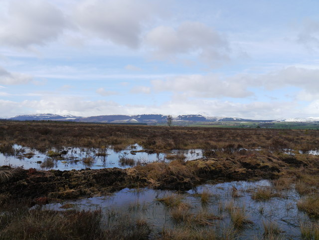
Flanders Moss Floods
Areas of standing water in this raised bog, as viewed from the (partially flooded) boardwalk.
 Map © Crown Copyright")
TIP: Click the map for more Large scale mapping
- Grid Square
- NS6498, 18 images (more nearby 🔍)
- Photographer
- James T M Towill (more nearby)
- Date Taken
- Wednesday, 22 March, 2017 (more nearby)
- Submitted
- Friday, 24 March, 2017
- Subject Location
-
OSGB36:
 NS 6488 9807 [10m precision]
WGS84: 56:9.3661N 4:10.6199W - Camera Location
-
OSGB36: NS 6488 9807
- View Direction
- NORTH (about 0 degrees)