2017
NH7187 : Newton Point
taken 7 years ago, near to Ardmore, Highland, Scotland
This is 1 of 3 images, with title Newton Point in this square
Newton Point
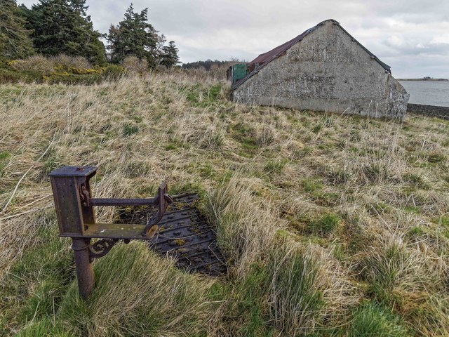
Old weighbridge by the former ferry pier at Newton Point
 Map © Crown Copyright")
TIP: Click the map for more Large scale mapping
- Grid Square
- NH7187, 15 images (more nearby 🔍)
- Photographer
- valenta (more nearby)
- Date Taken
- Sunday, 19 March, 2017 (more nearby)
- Submitted
- Friday, 31 March, 2017
- Subject Location
-
OSGB36:
 NH 7120 8772 [10m precision]
WGS84: 57:51.6208N 4:10.3445W - Camera Location
-
OSGB36: NH 7117 8773
- View Direction
- East-southeast (about 112 degrees)