2017
SS5532 : Phase 2 of the development on Bridge Wharf (Anchorwood Bank)
taken 7 years ago, near to Sticklepath, Devon, England
This is 1 of 2 images, with title Phase 2 of the development on Bridge Wharf (Anchorwood Bank) in this square
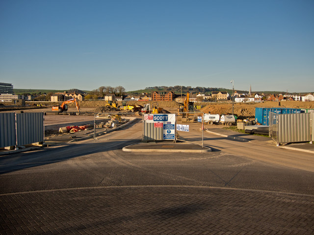
Phase 2 of the development on Bridge Wharf (Anchorwood Bank)
Since January (see: SS5532 : Phase 2 of the development on Bridge Wharf (Anchorwood Bank)) a mound of earth has been moved from the left side to the right side.
Bridge Wharf (Anchorwood Bank), Barnstaple
Recently the site of the Shapland & Petter Raleigh Cabinet Works and prior to this a shipbuilding yard known as Bridge Wharf or Taw Wharf. This site is now referred to as Anchorwood Bank although it is only the periphery bordering on the River Taw which has been known as such.
For information on this development visit this site: Link
 Map © Crown Copyright")
TIP: Click the map for more Large scale mapping
- Grid Square
- SS5532, 857 images (more nearby 🔍)
- Photographer
- Roger A Smith (more nearby)
- Date Taken
- Thursday, 6 April, 2017 (more nearby)
- Submitted
- Sunday, 16 April, 2017
- Subject Location
-
OSGB36:
 SS 5550 3291 [10m precision]
WGS84: 51:4.6361N 4:3.8481W - Camera Location
-
OSGB36: SS 55473 32854
- View Direction
- North-northeast (about 22 degrees)