2016
SP4141 : Benchmark on 'Black Swan House', Stratford Road
taken 8 years ago, near to Wroxton, Oxfordshire, England
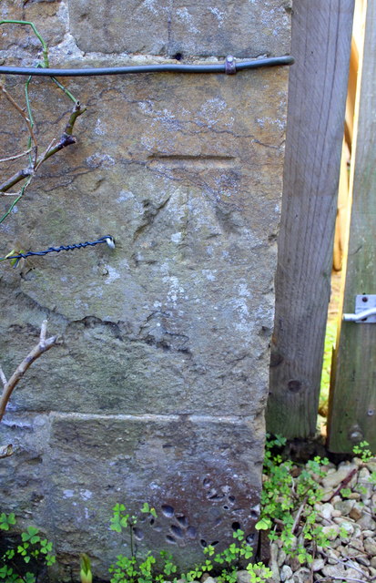
Benchmark on 'Black Swan House', Stratford Road
Ordnance Survey cut mark benchmark described on the Bench Mark Database at Link
 Map © Crown Copyright")
TIP: Click the map for more Large scale mapping
- Grid Square
- SP4141, 112 images (more nearby 🔍)
- Photographer
- Roger Templeman (more nearby)
- Date Taken
- Wednesday, 20 April, 2016 (more nearby)
- Submitted
- Monday, 17 April, 2017
- Subject Location
-
OSGB36:
 SP 4159 4185 [10m precision]
WGS84: 52:4.4076N 1:23.6768W - Camera Location
-
OSGB36: SP 4159 4185
- View Direction
- SOUTH (about 180 degrees)