2017
TQ3796 : River Lee Navigation at Brimsdown
taken 7 years ago, near to Sewardstone, Essex, England
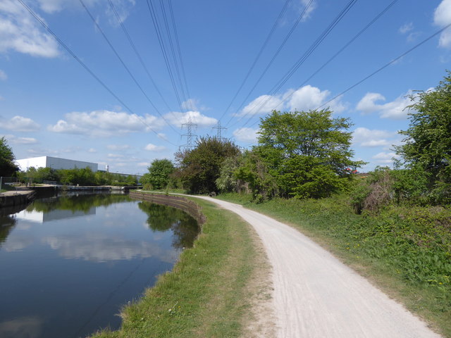
River Lee Navigation at Brimsdown
The original River Lea flowed 70 miles from Leagrove Marsh near Luton to the River Thames at Bow Creek. The River Lee Act of 1766 provided for the construction of 15 new cuts to straighten the course of the river by eliminating loops which made it difficult to navigate. This is one of those cuts and hence it is a navigation rather than a river. The Lea passes a little further to the east here, beyond King George's Reservoir. Historically the river is spelled Lea while the navigation is Lee.
Just visible beyond the trees on the right is the embankment of King George's Reservoir where an orange JCB can be seen working. The excavation and building of the surrounding embankment of the reservoir, nearly five miles in length, was carried out almost entirely by a manual labour force of 1,000 navvies, and the surplus excavated clay was spread over part of Hackney Marsh. In 1913 King George Vth and Queen Mary named the reservoir and pressed the buttons allowing water from the River Lea to start flowing into the storage bowl.
Just visible beyond the trees on the right is the embankment of King George's Reservoir where an orange JCB can be seen working. The excavation and building of the surrounding embankment of the reservoir, nearly five miles in length, was carried out almost entirely by a manual labour force of 1,000 navvies, and the surplus excavated clay was spread over part of Hackney Marsh. In 1913 King George Vth and Queen Mary named the reservoir and pressed the buttons allowing water from the River Lea to start flowing into the storage bowl.
 Map © Crown Copyright")
TIP: Click the map for more Large scale mapping
- Grid Square
- TQ3796, 31 images (more nearby 🔍)
- Photographer
- Marathon (more nearby)
- Date Taken
- Wednesday, 19 April, 2017 (more nearby)
- Submitted
- Wednesday, 19 April, 2017
- Subject Location
-
OSGB36:
 TQ 370 968 [100m precision]
WGS84: 51:39.2303N 0:1.2421W - Camera Location
-
OSGB36: TQ 370 967
- View Direction
- North-northwest (about 337 degrees)