2003
TQ7120 : Waterfalls on stream feeding Darwell Reservoir
taken 21 years ago, near to Netherfield, East Sussex, England
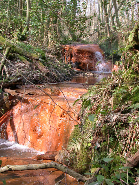
Waterfalls on stream feeding Darwell Reservoir
The stream takes a sinuous course here, so in places, such as here, it flows the opposite way to its general trend. If I read the geology right, the iron staining is from iron in the Wadhurst Clay, and the rock outcrop is sandstone in the Ashdown Beds.
 Map © Crown Copyright")
TIP: Click the map for more Large scale mapping
- Grid Square
- TQ7120, 44 images (more nearby 🔍)
- Photographer
- Robin Webster (more nearby)
- Date Taken
- Saturday, 22 March, 2003 (more nearby)
- Submitted
- Friday, 21 April, 2017
- Subject Location
-
OSGB36:
 TQ 7150 2029 [10m precision]
WGS84: 50:57.3912N 0:26.4303E - Camera Location
-
OSGB36: TQ 7151 2029
- View Direction
- West-northwest (about 292 degrees)