2016
SK0517 : New canalside housing near Brereton, Staffordshire
taken 8 years ago, near to Brereton, Staffordshire, England
This is 1 of 2 images, with title New canalside housing near Brereton, Staffordshire in this square
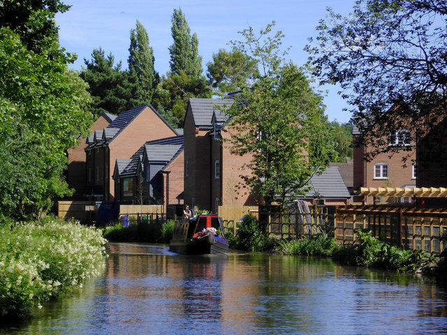
New canalside housing near Brereton, Staffordshire
Trent and Mersey Canal, looking south-east towards Armitage.
Trent and Mersey Canal
The Trent and Mersey Canal is 93·5 miles in length from Derwent Mouth to Preston Brook. The first cut was made by Josiah Wedgwood in July 1766 at Middleport (Stoke-on-Trent). The eastern section between Derwent Mouth and Shugborough (the junction with the Staffordshire and Worcestershire Canal) was already operational by 1770 and the whole canal through to Preston Brook, where it linked with the Bridgewater Canal was open for business by 1777. James Brindley was the engineer until his death in 1772. There are seventy-six locks en route to raise and lower the water level where hills impede the course. There are four tunnels, including the famous Harecastle Tunnel near Stoke-on-Trent.
 Map © Crown Copyright")
TIP: Click the map for more Large scale mapping
- Grid Square
- SK0517, 125 images (more nearby 🔍)
- Photographer
- Roger D Kidd (more nearby)
- Date Taken
- Sunday, 17 July, 2016 (more nearby)
- Submitted
- Friday, 21 April, 2017
- Subject Location
-
OSGB36:
 SK 0529 1715 [10m precision]
WGS84: 52:45.1164N 1:55.3839W - Camera Location
-
OSGB36: SK 0525 1718
- View Direction
- Southeast (about 135 degrees)