2017
NH7286 : Meikle Ferry
taken 7 years ago, near to Ardmore, Highland, Scotland
This is 1 of 5 images, with title starting with Meikle Ferry in this square
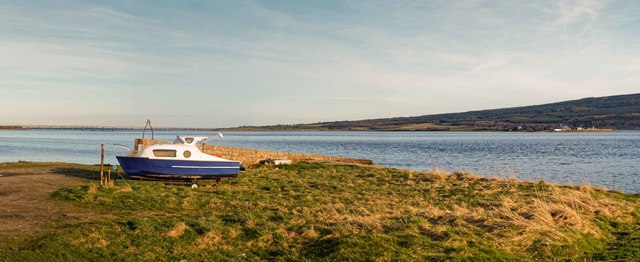
Meikle Ferry
Meikle Ferry slipway, looking across to Ferry Point and the Dornoch Bridge
 Map © Crown Copyright")
TIP: Click the map for more Large scale mapping
- Grid Square
- NH7286, 16 images (more nearby 🔍)
- Photographer
- valenta (more nearby)
- Date Taken
- Sunday, 2 April, 2017 (more nearby)
- Submitted
- Saturday, 22 April, 2017
- Subject Location
-
OSGB36:
 NH 7286 8695 [10m precision]
WGS84: 57:51.2347N 4:8.6425W - Camera Location
-
OSGB36: NH 7282 8695
- View Direction
- EAST (about 90 degrees)