2017
NO2507 : Lane from Castle Park to Well Brae, Falkland
taken 7 years ago, near to Falkland, Fife, Scotland
This is 1 of 2 images, with title Lane from Castle Park to Well Brae, Falkland in this square
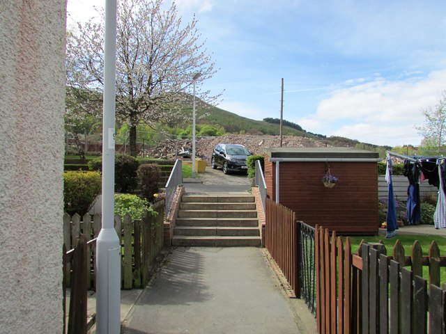
Lane from Castle Park to Well Brae, Falkland
This is one of several short lanes connecting Well Brae with Castle Park NO2507 : Castle Park, Falkland The demolition site of the former St John's Works NO2507 : Demolition site, Falkland can be seen.
See Falkland article Link
See Falkland article Link
 Map © Crown Copyright")
TIP: Click the map for more Large scale mapping
- Grid Square
- NO2507, 525 images (more nearby 🔍)
- Photographer
- Bill Kasman (more nearby)
- Date Taken
- Sunday, 23 April, 2017 (more nearby)
- Submitted
- Sunday, 23 April, 2017
- Subject Location
-
OSGB36:
 NO 2539 0718 [10m precision]
WGS84: 56:15.0751N 3:12.3422W - Camera Location
-
OSGB36: NO 2540 0718
- View Direction
- West-southwest (about 247 degrees)