2017
SP2047 : View to the northern Cotswold Hills
taken 7 years ago, near to Admington, Warwickshire, England
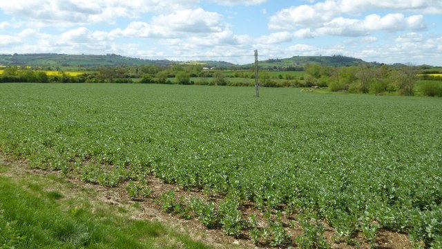
View to the northern Cotswold Hills
View across farmland around Admington to two of the most northerly Cotswold Hills. Most of the Cotswold Hills are within the county Gloucestershire, some in South Gloucestershire, Worcestershire and reaching eastwards to include a little of Oxfordshire. These two hills are Ilmington Down on the left, and the outlier of Meon Hill on the right. Meon Hill is the only Cotswold outlier in the county of Warwickshire, while Ilmington Down it the highest point in Warwickshire.
 Map © Crown Copyright")
TIP: Click the map for more Large scale mapping
- Grid Square
- SP2047, 27 images (more nearby 🔍)
- Photographer
- Philip Halling (more nearby)
- Date Taken
- Tuesday, 25 April, 2017 (more nearby)
- Submitted
- Thursday, 27 April, 2017
- Subject Location
-
OSGB36:
 SP 2097 4707 [10m precision]
WGS84: 52:7.2931N 1:41.7080W - Camera Location
-
OSGB36: SP 2104 4713
- View Direction
- Southwest (about 225 degrees)