2016
SP0994 : Split-level stretch of King's Road, between Kingstanding and New Oscott, Birmingham
taken 8 years ago, near to Kingstanding, Birmingham, England
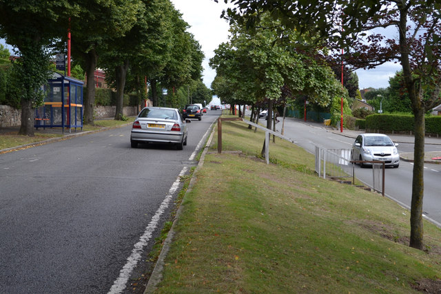
Split-level stretch of King's Road, between Kingstanding and New Oscott, Birmingham
King's Road is running obliquely along the flank of a ridge. This is near the junction with Tottenham Crescent, right SP0994 : East end of Tottenham Crescent, New Oscott, north Birmingham. Steps make it safer to reach a bus stop from across the road.
 Map © Crown Copyright")
TIP: Click the map for more Large scale mapping
- Grid Square
- SP0994, 46 images (more nearby 🔍)
- Photographer
- Robin Stott (more nearby)
- Date Taken
- Thursday, 4 August, 2016 (more nearby)
- Submitted
- Sunday, 30 April, 2017
- Subject Location
-
OSGB36:
 SP 0913 9464 [10m precision]
WGS84: 52:32.9719N 1:52.0073W - Camera Location
-
OSGB36: SP 0907 9466
- View Direction
- East-southeast (about 112 degrees)