Geograph - photograph every grid square
2017
NT2339
: Manor Water
taken
7 years ago
,
near
to
Kirkton Manor
, Scottish Borders, Scotland
This is 1 of
6 images, with title starting with Manor
in this square
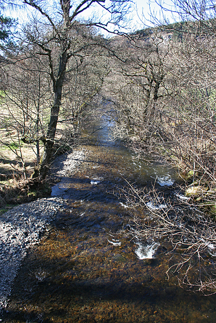
Manor Water
Looking downstream from the parapet of Old Manor Bridge. After a recent dry spell, the water is low and very clear.
© Copyright
Anne Burgess
and licensed for
reuse
under this
Creative Commons Licence
.
Licensing
Download
Share...
Share this photo via Twitter
Share this photo via Facebook
Share this photo via Pinterest
Share this photo via Flipboard
Share this photo via email/e-card
Grab a Stamped/Watermarked Image
Mark
👍🏻
Like Image
👍🏻
Like Description
Update Information
Contact Contributor
Geographical Context:
Rivers, Streams, Drainage
This photo is linked from:
Automatic Clusters
: ·
Manor Water [21]
·
TIP: Click the map for more Large scale mapping
Grid Square
NT2339
, 161 images (
more nearby
🔍
)
Photographer
Anne Burgess
(
more nearby
)
Date Taken
Saturday, 25 March, 2017 (
more nearby
)
Submitted
Thursday, 11 May, 2017
Subject Location
OSGB36:
NT 2307 3941
[10m precision]
WGS84:
55:38.5275N
3:13.4267W
Camera Location
OSGB36:
NT 2310 3939
View Direction
Northwest (about 315 degrees)
NW
N
NE
W
Go
E
SW
S
SE
Discuss NT2339
View this location on ...
Geograph Coverage Map (includes OSM etc)
Geograph Links Page
Open in Google Maps
Navigate to location with Google Maps
Open in Google Earth Pro
Open in Google Earth for Web
Open in Bing Maps
Navigate with Google Maps
Lookup nearest Postcode
Image Type
(about)
:
geograph
This page has been
viewed
about
13
times
☰
Home
View
Search
Marked Images
Maps
Browser
Explore
Showcase
New Images
Collections
Interact
Games
Discussions
Blog
Contributors
Submit
Statistics
Leaderboards
General
FAQ
Help Pages
Sitemap
Contact Us
Support Us
sponsored by
🔍
What to search:
Photos
Enter keywords or a location/postcode to search nearby images
Photos near NT2339
Enter a Grid Reference
Placenames
Collections
Website Pages
Everything
Others:
Advanced Search
|
Image Browser
Or:
Coverage Map
|
Searchable Map
You are not logged in
login
|
register