2017
TA0489 : Castle Road, Scarborough, a gateway and a boundary stone
taken 7 years ago, near to Scarborough, North Yorkshire, England
This is 1 of 5 images, with title starting with Castle Road in this square
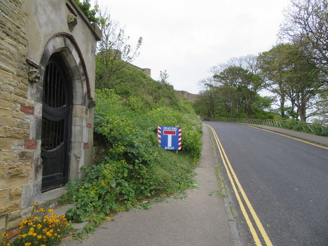
Castle Road, Scarborough, a gateway and a boundary stone
Looking up Castle Road towards the entrance to Scarborough Castle. The gateway on the left is for 'The Towers', and just next to the stone corner there is an old War Department boundary stone. The stone is marked on the 1852 Ordnance Survey map and pre-dates the building of 'The Towers'. For a close up of the stone see TA0489 : War Department boundary stone near Scarborough Castle
 Map © Crown Copyright")
TIP: Click the map for more Large scale mapping
- Grid Square
- TA0489, 685 images (more nearby 🔍)
- Photographer
- John S Turner (more nearby)
- Date Taken
- Tuesday, 9 May, 2017 (more nearby)
- Submitted
- Saturday, 13 May, 2017
- Subject Location
-
OSGB36:
 TA 0479 8912 [10m precision]
WGS84: 54:17.2185N 0:23.5052W - Camera Location
-
OSGB36: TA 0477 8912
- View Direction
- EAST (about 90 degrees)