2017
SE0427 : Spanefield Lane, Warley
taken 7 years ago, near to Mount Tabor, Calderdale, England
This is 1 of 2 images, with title Spanefield Lane, Warley in this square
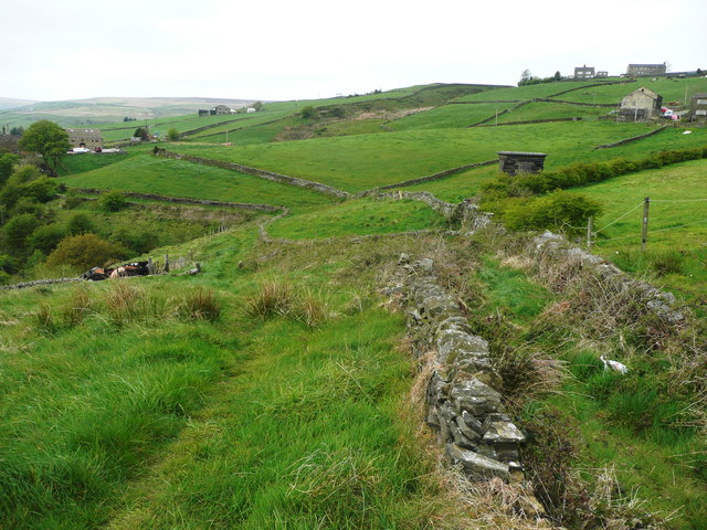
Spanefield Lane, Warley
This is part of Halifax Bridleway 188. Strangely, the narrow lane on the right is a dead end, with a wall across it. The bridleway stays on the left side of the wall.
 Map © Crown Copyright")
TIP: Click the map for more Large scale mapping
- Grid Square
- SE0427, 128 images (more nearby 🔍)
- Photographer
- Humphrey Bolton (more nearby)
- Date Taken
- Monday, 8 May, 2017 (more nearby)
- Submitted
- Sunday, 14 May, 2017
- Subject Location
-
OSGB36:
 SE 0498 2746 [10m precision]
WGS84: 53:44.6097N 1:55.5583W - Camera Location
-
OSGB36: SE 0498 2746
- View Direction
- North-northwest (about 337 degrees)