2017
NC2447 : Linear drainage in Sutherland
taken 7 years ago, near to Laxford Bridge, Highland, Scotland
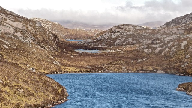
Linear drainage in Sutherland
Although not named on the OS map, these three lochs form part of the Scourie Hotel's 'Dour" beat. The nearest is Planks with a small lochan above it and the largest of the Dour lochs above that.
 Map © Crown Copyright")
TIP: Click the map for more Large scale mapping
- Grid Square
- NC2447, 10 images (more nearby 🔍)
- Photographer
- AlastairG (more nearby)
- Date Taken
- Saturday, 6 May, 2017 (more nearby)
- Submitted
- Monday, 15 May, 2017
- Subject Location
-
OSGB36:
 NC 2442 4787 [10m precision]
WGS84: 58:23.0358N 5:0.2924W - Camera Location
-
OSGB36: NC 2438 4775
- View Direction
- North-northeast (about 22 degrees)