2017
SE1080 : Shooters Track over Colsterdale Moor
taken 7 years ago, near to Colsterdale, North Yorkshire, England
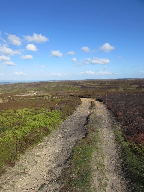
Shooters Track over Colsterdale Moor
Originally built to allow access to Speedwell Coal Pit and therefore must have been put in before the shaft was finished around 1737.
Now used to reach some grouse butts that are close to the watershed with Coverdale.
Now used to reach some grouse butts that are close to the watershed with Coverdale.
 Map © Crown Copyright")
TIP: Click the map for more Large scale mapping
- Grid Square
- SE1080, 3 images (more nearby 🔍)
- Photographer
- Matthew Hatton (more nearby)
- Date Taken
- Sunday, 14 May, 2017 (more nearby)
- Submitted
- Wednesday, 17 May, 2017
- Subject Location
-
OSGB36:
 SE 1087 8031 [10m precision]
WGS84: 54:13.1043N 1:50.0881W - Camera Location
-
OSGB36: SE 1082 8033
- View Direction
- East-southeast (about 112 degrees)