2017
TA1029 : Dry dock, Dock Office Row, Hull
taken 7 years ago, near to Kingston Upon Hull, England
This is 1 of 4 images, with title starting with Dry in this square
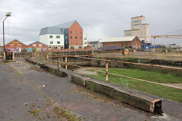
Dry dock, Dock Office Row, Hull
Grade II Listed early 19th century dry dock that is shown on the 1853 OS survey. An 1886 map shows, roughly on the line of Charlotte Street, was Bridge Street and North Bridge adjacent to the dry dock that is described as 'W Sanderson North Bridge Dry Dock (wood paved)'. In 1772 Mr Blaydes is described as having a shipyard just south of the road bridge that was 'taken' by Wm Gibson in 1787. In 1805 a notice to 'Merchants, owners, and masters of ships' informs that 'Wm Gibson has removed from the shipyard and dry dock which he lately occupied, adjoining the North Bridge to the large and commodious opposite the Dock Bason....' Can we infer from that the dock was built between 1787 and 1805?
 Map © Crown Copyright")
TIP: Click the map for more Large scale mapping
- Grid Square
- TA1029, 1231 images (more nearby 🔍)
- Photographer
- Jo and Steve Turner (more nearby)
- Date Taken
- Friday, 14 April, 2017 (more nearby)
- Submitted
- Friday, 19 May, 2017
- Subject Location
-
OSGB36:
 TA 1024 2914 [10m precision]
WGS84: 53:44.8191N 0:19.7878W - Camera Location
-
OSGB36: TA 1021 2915
- View Direction
- East-southeast (about 112 degrees)