2017
TL3973 : Hanson Aggregates quarry
taken 7 years ago, near to Earith, Cambridgeshire, England
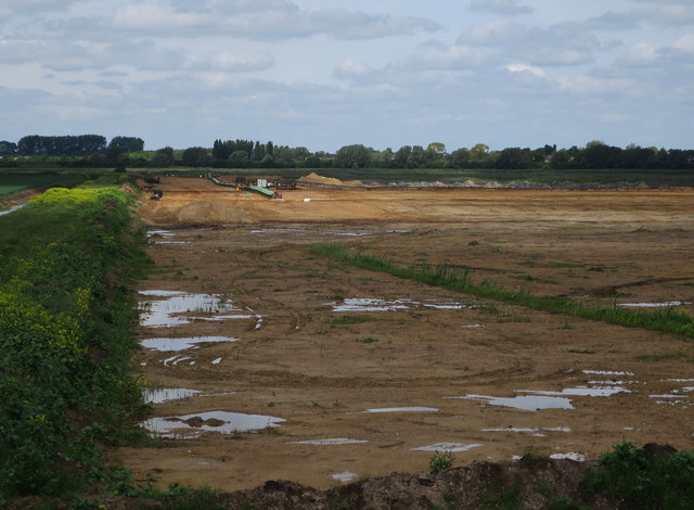
Hanson Aggregates quarry
Sand and gravel extraction, with conveyor belts carrying the material to the processing plant across the river, TL3672 : Conveyor belt tunnel. After extraction the land is being landscaped into a wetland nature reserve and handed over to the RSPB, the early phases of which are now well developed reedbeds, TL3772 : Cell 1, Ouse Fen RSPB reserve.
 Map © Crown Copyright")
TIP: Click the map for more Large scale mapping
- Grid Square
- TL3973, 23 images (more nearby 🔍)
- Photographer
- Hugh Venables (more nearby)
- Date Taken
- Sunday, 21 May, 2017 (more nearby)
- Submitted
- Sunday, 4 June, 2017
- Subject Location
-
OSGB36:
 TL 3956 7332 [10m precision]
WGS84: 52:20.4126N 0:2.8258E - Camera Location
-
OSGB36: TL 39675 73155
- View Direction
- North-northwest (about 337 degrees)