2017
SE9986 : Bridleway East Ayton
taken 7 years ago, near to East Ayton, North Yorkshire, England
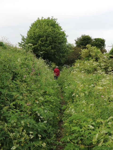
Bridleway East Ayton
This track is a public bridleway which runs off Moor Lane up on to East Ayton Moor. Although it runs alongside a shallow valley, at this point it forms a hollow way and may be an extension of Skell Dykes at SE9987;. It is one of the ancient routes on to this moor, possibly for droving
 Map © Crown Copyright")
TIP: Click the map for more Large scale mapping
- Grid Square
- SE9986, 11 images (more nearby 🔍)
- Photographer
- Christopher Hall (more nearby)
- Date Taken
- Wednesday, 7 June, 2017 (more nearby)
- Submitted
- Thursday, 8 June, 2017
- Subject Location
-
OSGB36:
 SE 992 862 [100m precision]
WGS84: 54:15.7432N 0:28.6754W - Camera Location
-
OSGB36: SE 992 861
- View Direction
- NORTH (about 0 degrees)