2017
NG5044 : Am Bile and the Sound of Raasay
taken 7 years ago, near to Torvaig, Isle of Skye, Scotland
Am Bile and the Sound of Raasay
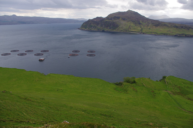
The grazing land in the foreground lies on a layer of sedimentary rock. (See NG5044 : Am Bile for more information.)
A fish farm is on this side of the approach to Portree harbour. Ben Tianavaig guards the opposite side.
Raasay is across the Sound of Raasay on the left, with the highest summit, Dun Caan, prominent. Glamaig is in the far distance (centre right).
A fish farm is on this side of the approach to Portree harbour. Ben Tianavaig guards the opposite side.
Raasay is across the Sound of Raasay on the left, with the highest summit, Dun Caan, prominent. Glamaig is in the far distance (centre right).
 Map © Crown Copyright")
TIP: Click the map for more Large scale mapping
- Grid Square
- NG5044, 19 images (more nearby 🔍)
- Photographer
- Ian Taylor (more nearby)
- Date Taken
- Monday, 22 May, 2017 (more nearby)
- Submitted
- Saturday, 10 June, 2017
- Subject Location
-
OSGB36:
 NG 501 445 [100m precision]
WGS84: 57:25.3209N 6:9.8102W - Camera Location
-
OSGB36: NG 500 446
- View Direction
- South-southeast (about 157 degrees)