2017
SX9691 : A379 at Sandy Park
taken 7 years ago, near to Clyst st Mary, Devon, England
This is 1 of 3 images, with title A379 at Sandy Park in this square
A379 at Sandy Park
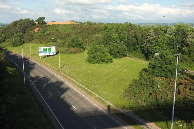
Looking the other way to SX9691 : Junction on A379 from the Baker Bridge, with hardly a glimpse of the southwest-bound carriageway, separated as it is by about 50 metres of grass and trees from the northeast-bound one in the foreground. The road sign indicates the proximity of junction 30 of the M5 at Sandy Gate. This is also the site of two battles, on 15 December 1455 and 4-5 August 1549 (the latter dates are given on the map, but Link seems to vary by a day). The sandy knoll left of centre is close to where the information appears on the larger scale OS maps.
 Map © Crown Copyright")
TIP: Click the map for more Large scale mapping
- Grid Square
- SX9691, 176 images (more nearby 🔍)
- Photographer
- Derek Harper (more nearby)
- Date Taken
- Saturday, 3 June, 2017 (more nearby)
- Submitted
- Monday, 12 June, 2017
- Subject Location
-
OSGB36:
 SX 9633 9117 [10m precision]
WGS84: 50:42.6533N 3:28.1800W - Camera Location
-
OSGB36: SX 9627 9118
- View Direction
- EAST (about 90 degrees)