2017
J3067 : The River Lagan at the Drum Bridge, Dunmurry (June 2017)
taken 7 years ago, near to Drumbeg, Co Down, Northern Ireland
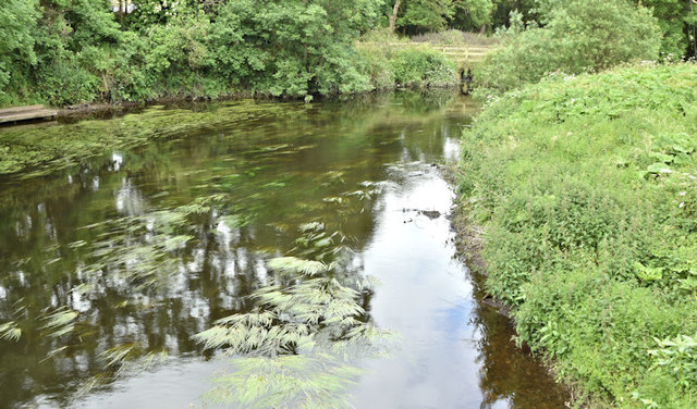
The River Lagan at the Drum Bridge, Dunmurry (June 2017)
The view, upstream, from the Drum Bridge. The Lagan is low enough to reveal some mud along the bank at lower right.
The River Lagan at the Drum Bridge
Photographs showing the changing seasons, on the River Lagan, at the Drum Bridge on the Upper Malone Road.
Loading map... (JavaScript required)
- Grid Square
- J3067, 257 images (more nearby 🔍)
- Photographer
- Albert Bridge (more nearby)
- Date Taken
- Thursday, 15 June, 2017 (more nearby)
- Submitted
- Friday, 16 June, 2017
- Subject Location
-
Irish:
 J 305 670 [100m precision]
WGS84: 54:32.0983N 5:59.0161W - Camera Location
-
Irish: J 306 670
- View Direction
- Southwest (about 225 degrees)