2017

SU1498 : B52s at Fairford

taken 7 years ago, near to Dunfield, Gloucestershire, England
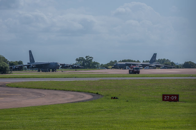
B52s at Fairford
B52s at Fairford
Looking across the runway at RAF Fairford towards B52 Stratofortresses 61-0020 and 60-0002 parked up, two of three examples at the base that day. 60-002, on the right, had just landed having done a flypast at Cosford Airshow earlier in the day.
RAF Fairford :: SU1598

RAF Fairford was constructed in 1944 as a base for the D-Day landings in Normandy. After the end of The Second World War, and the onset of the Cold War, it was one of a number of bases made available for use by the USAF Strategic Air Command. As a consequence in 1950 it was transferred to the USAF who extended the runway to 3000m in length, enabling it to be used by their largest bombers. The long runway meant that it was also used as the UK test centre for Concorde and was also a designated landing emergency landing base for the Space Shuttle.

It served as a USAF base for various campaigns, but ceased its formal role in 1990, after which it was maintained on a standby basis. Nevertheless it continues its use as a forward base for large USAF bombers operating further east, including NATO operations in the former Yugoslavia in the 1990s and more recently in Iraq and Afghanistan. As a result it plays frequent host to B52 Stratofortresses and B1 Lancers as well as some visits from U2 Dragon Lady spy planes and B2 Stealth bombers.

The base hosts the anneal Royal International Air Tattoo, one of the world's largest military airshows.


Creative Commons Licence [Some Rights Reserved]   © Copyright Ian Capper and licensed for reuse under this Creative Commons Licence.
Geographical Context: Air transport Defence, Military other tags: RAF Fairford B52 Stratofortress 61-0020 60-0002 Click a tag, to view other nearby images.
1:50,000 Modern Day Landranger(TM) Map © Crown Copyright
+
+
1:50,000 Modern Day Landranger(TM) Map © Crown Copyright
TIP: Click the map for more Large scale mapping
Grid Square
SU1498, 46 images   (more nearby 🔍)
Photographer
Ian Capper   (more nearby)
Date Taken
Sunday, 11 June, 2017   (more nearby)
Submitted
Saturday, 17 June, 2017
Subject Location
OSGB36: geotagged! SU 141 984 [100m precision]
WGS84: 51:41.0737N 1:47.7869W
Camera Location
OSGB36: geotagged! SU 142 985
View Direction
South-southwest (about 202 degrees)
Clickable map
+
NW N NE
W Go E
SW S SE
Image Type (about): geograph 
This page has been viewed about 29 times
You are not logged in login | register