2017
NB4217 : Cairn, Sidhean Rubha na Creige Mòire, Isle of Lewis
taken 7 years ago, near to Calbost, Isle of Lewis And Harris, Na h-Eileanan an Iar, Scotland
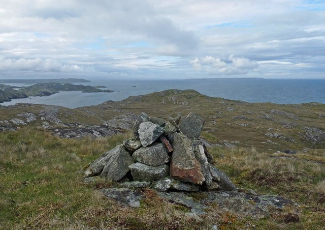
Cairn, Sidhean Rubha na Creige Mòire, Isle of Lewis
Under the cairn is an OS bolt. It is marked with the triangulation pillar symbol on the OS 1:25,000 map, but is not shown on the 1:50,000.
 Map © Crown Copyright")
TIP: Click the map for more Large scale mapping
- Grid Square
- NB4217 (more nearby 🔍)
- Photographer
- Claire Pegrum (more nearby)
- Date Taken
- Monday, 5 June, 2017 (more nearby)
- Submitted
- Saturday, 17 June, 2017
- Subject Location
-
OSGB36:
 NB 42054 17789 [1m precision]
WGS84: 58:4.4294N 6:22.5794W - Camera Location
-
OSGB36: NB 42054 17789
- View Direction
- North-northeast (about 22 degrees)