2017
J1515 : Sea defences protecting the Greenway Track south of Greer's Quay
taken 7 years ago, 3 km from Omeath, Co Louth, Ireland
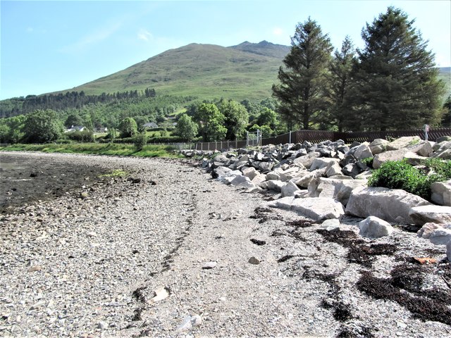
Sea defences protecting the Greenway Track south of Greer's Quay
Slieve Foye forms the background.
An Bealach Glas/ the Omeath to Carlingford Greenway
Completed in the summer of 2014 at a cost of some 600,000 Euros the Greenway runs along the southern shore of Carlingford Lough, following the former track bed of the Dundalk, Newry and Greenore Railway (later the Great Northern Railway) between Omeath and Carlingford. It is very popular with cyclists and dog walkers. More adventurous walkers may prefer to follow the Tain Way Loop which runs across the lower, forested, slopes of the Carlingford Mountains between Greer's Quay and Carlingford
Loading map... (JavaScript required)
- Grid Square
- J1515, 72 images (more nearby 🔍)
- Photographer
- Eric Jones (more nearby)
- Date Taken
- Saturday, 17 June, 2017 (more nearby)
- Submitted
- Monday, 19 June, 2017
- Subject Location
-
Irish:
 J 157 150 [100m precision]
WGS84: 54:4.2880N 6:13.9350W - Camera Location
-
Irish: J 157 150
- View Direction
- East-southeast (about 112 degrees)