2017
SY4690 : West Bay Deep Water Harbour
taken 7 years ago, near to West Bay, Dorset, England
This is 1 of 171 images, with title starting with West Bay in this square
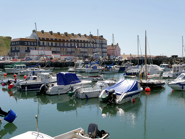
West Bay Deep Water Harbour
West Bay, also known as Bridport Harbour, is a small harbour settlement and seaside resort at the mouth of the River Brit approximately 1½ miles south of Bridport. Bridport historically needed a harbour to export its principal products, rope and nets. The harbour at West Bay is not a natural landscape feature and it has a long history of having been silted up, blocked by shingle and damaged by storms, and each time repairs, improvements and enlargements have subsequently been made. The harbour has been moved twice: it was originally 1 mile inland, then was moved to the coast beside the East Cliff, then was moved again 300 yards along the coast to the west, where it is now located. The main commercial trade of the harbour, exporting Bridport's ropes and nets, declined in the second half of the 19th century and when the railway arrived in 1884, attempts were made to provide the settlement with the facilities of a resort, and today West Bay has a mixed economy of tourism and fishing (Link Wikipedia).
 Map © Crown Copyright")
TIP: Click the map for more Large scale mapping
- Grid Square
- SY4690, 1030 images (more nearby 🔍)
- Photographer
- David Dixon (more nearby)
- Date Taken
- Sunday, 18 June, 2017 (more nearby)
- Submitted
- Friday, 23 June, 2017
- Subject Location
-
OSGB36:
 SY 462 903 [100m precision]
WGS84: 50:42.6385N 2:45.7998W - Camera Location
-
OSGB36: SY 461 904
- View Direction
- South-southeast (about 157 degrees)